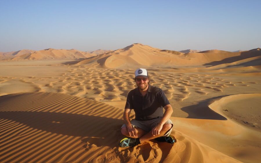
The Kenai Peninsula is one of my favorite places in the world to go hiking, and although it can get more crowded in the peak summer months, you can find quieter hikes to do. Having said that, even in the busier times, it never gets too crowded.
I spent a month around the Kenai Peninsula staying with a friend who lives there, who is also an avid hiker, and he showed me some great places to hike.
If you love big views and big solitude, these hikes on the Kenai Peninsula reward you with a step just a little off the beaten track. Skip the staples and you’ll find alpine lakes, empty ridgelines, and wildlife-rich valleys.
Why Less Crowded Hikes on The Kenai Peninsula Are Totally Doable
The Kenai Peninsula is famous (Seward, Kenai Fjords, Homer), but hiking pressure concentrates on a handful of headliners (Harding Icefield, Exit Glacier area, popular overlooks). By choosing alternate trailheads, moderate-length climbs, and longer approaches (that day-hikers often skip), you can get jaw-dropping scenery with far fewer people.
This guide focuses on:
- Trails with lighter visitation (or quieter segments/times)
- Moderate to strenuous routes that deter casual crowds
- A mix of forest, lake, alpine, and ridge objectives
- One standout hike in Kachemak Bay State Park (boat-access wilderness)
Quick Planning Essentials
- Season: Snow can linger into early/mid-June on higher trails; late June–early September is prime. Shoulder seasons can be glorious (and quiet), but expect mud, lingering snow patches, and swift creek crossings.
- Bears & wildlife: You’re in brown/black bear country—carry bear spray, make noise, store food properly, and know what to do if you encounter wildlife.
- Weather: Coastal systems change fast—layers, rain shell, warm hat, gloves, even in summer.
- Maps: Download offline maps from the Forest Service/Refuge or bring a paper map/compass. Official trail pages and PDF maps are linked in citations throughout.
- Trail conditions: Bridges, mud, and blowdowns vary year to year. Check the Chugach National Forest and Kenai National Wildlife Refuge pages for current notes; Kachemak Bay trails often require water taxi logistics.
The “Less Crowded” Strategy on the Kenai
- Pick the longer line: Trails like Johnson Pass and Devil’s Pass shed crowds beyond the first miles.
- Choose alternate trailheads: For Lost Lake, the Primrose side often feels quieter than the main Seward-side start.
- Go inland or refuge-side: The Skilak Lake area in the Kenai National Wildlife Refuge sees fewer hikers than the Seward Highway hotspots.
- Start early or late: Even popular trails feel empty at dawn or after 5 pm in summer light.
- Day-hike a backpacking route: Out-and-back samples on through-trails (Johnson/Resurrection network) deliver solitude without committing to a full traverse.
The Hikes (North-to-South Flow)
Difficulty ratings reflect typical summer conditions. Always check current advisories and bring proper gear.
1) Lost Lake via Primrose Trail (Seward area) — Big Alpine for Fewer People

Why it’s quieter: Many hikers start from the busier Seward-side trailhead. The Primrose approach is longer and harder—deterring crowds—but it rewards with expansive tundra and fewer voices on the breeze.
Stats: ~13–14 miles round trip to Lost Lake (or make a through-hike with a shuttle). Expect ~2,600–2,700 ft gain on the Primrose side.
What you’ll see: Spruce and hemlock forest giving way to open alpine with glacially carved basins and wildflowers. In clear weather, sweeping Kenai Mountains views and mirror-still tarns.
Pro tips: Early July–August for snow-free meadows; bring bug protection. Consider a point-to-point (Primrose ⇄ Seward trailheads) with a car shuttle to sample both sides. Watch for bikers—this is a multi-use trail.
2) Johnson Pass (Moose Pass) — Classic, Scenic, and Surprisingly Quiet in Sections
Why it’s quieter: It’s long—23 miles one-way—so most day users only sample the ends, leaving the middle blissfully calm.
Stats: 23 mi one-way, ~1,000–2,700 ft total gain depending on source/segment; 2–3 days typical for backpackers, but day-hikers can do out-and-back samplers from either trailhead.
What you’ll see: Lush valleys, lakes, boardwalks across wet meadows, bridges over Bench and Center creeks, and mountain views that open up as you climb.
Pro tips: North trailhead offers rugged stretches early; south has smoother grades—choose based on your comfort. Mid-June can be muddy; mosquitoes thrive near wetlands—headnets help.
3) Devil’s Pass via Devil’s Creek (Near Cooper Landing) — A Wild V-Shaped Valley
Why it’s quieter: It’s a 10-mile climb to reach the alpine junction with Resurrection Pass—the distance alone thins out company.
Stats: ~20 miles round trip if you tag the pass; moderate-strenuous with steady elevation.
What you’ll see: Rapid transition from forest to tundra, a photogenic mid-route waterfall, then a broad alpine basin at the pass with berry slopes and big horizons.
Pro tips: Weather is exposed and windy above treeline—pack layers. Book the Devil’s Pass Cabin if you want solitude with a roof (10 mi from the trailhead).
4) Carter Lake (Near Moose Pass) — Short, Steep, and Peaceful
Why it’s quieter: The initial climb is steep, and the trail can be muddy—two quick filters that keep crowds down.
Stats: ~4 miles round trip to Carter Lake; add distance to reach Crescent Lake via the connecting trail. Expect ~1,100–1,350 ft gain.
What you’ll see: Forested ascent to a turquoise subalpine lake, wildflowers in season, and optional extension to the larger Crescent Lake basin.
Pro tips: Great half-day option with a real “alpine” feel. Fishing opportunities at Carter/Crescent (check current regs—grayling seasons vary).
5) Crescent Lake from Crescent Creek (Cooper Landing) — Big Country, Light Visitation
Why it’s quieter: The Crescent Creek approach is longer and more rugged than many family hikes, with fords and brush—crowd control by nature.
Stats: ~12–13 miles round trip to reach the lake from Crescent Creek TH; moderate-strenuous depending on snow, water levels, and brush.
What you’ll see: Long valley walking through meadows and brush with mountains looming, then the stunning green waters of Crescent Lake.
Pro tips: Light visitation; expect sections that are rough/overgrown until mid-season. Consider a loop/through variation by linking with Carter Lake if you arrange a shuttle (route-finding and fitness required).
6) Hope Point (Historic Town of Hope) — Steep Climb, Huge Payoff
Why it’s quieter: It’s leg-burning steep, which keeps casual sightseers away.
Stats: 3.5–4+ miles one-way, 2,300–3,600 ft of gain depending on the turnaround/summit you choose (reports vary by route and measurement).
What you’ll see: Ridge-walking above Resurrection Creek Valley with panoramas over Cook Inlet and Turnagain Arm; on clearer days, a sweep of the Chugach.
Pro tips: The trail is relentless—trekking poles and steady pacing make it far more enjoyable. Trailhead sits just before Porcupine Campground at the end of the Hope Highway.
7) Fuller Lakes (Skilak Lake Road, Kenai National Wildlife Refuge) — Lakes & Wildlife, Fewer People
Why it’s quieter: It’s inland on the Skilak Lake Road, away from the coastal hubbub.
Stats: ~5–7 miles depending on whether you visit lower/upper lakes; ~1,400 ft of gain to Lower Fuller Lake.
What you’ll see: A climb through mixed spruce forest to subalpine lakes, beaver dams, and broad views toward Skilak Lake. Wildlife habitat shifts with elevation—great for naturalists.
Pro tips: Portions of the area burned in the 2019 Swan Lake Fire—expect open views and sun exposure. Bring bug spray; start early for mirror-calm lake photos.
8) Skilak Lookout (Kenai National Wildlife Refuge) — Short Effort, Big Vista
Why it’s quieter: Though popular with locals, it’s still less trafficked than highway showstoppers.
Stats: ~2–2.5 miles one-way from the Upper Skilak area to the viewpoint.
What you’ll see: A grandstand over Skilak Lake and the Kenai Mountains; on clear days, ridiculously photogenic.
Pro tips: Great sunset objective—pack a headlamp for the descent. Nearby Vista and Bear Mountain trails make for a satisfying mini-trifecta if you’re stacking viewpoints.
9) (Kenai replacement) Resurrection Pass via Primrose or Devil’s Pass Spur — Day Sample of a Legendary Route
Why it’s quieter: The Resurrection network is popular overall, but day-hiking into it from a side spur like Devil’s Pass or Primrose disperses hikers quickly; you can walk for an hour and be alone.
Stats: Choose your own adventure—turn around when you hit alpine meadows and you’ll still feel like you got a proper expedition.
What you’ll see: Broad tundra benches, berry patches in late summer, and far-reaching valley views.
Pro tips: Book public use cabins if turning it into an overnighter.
10) Kachemak Bay State Park: Sadie Knob or Grewingk Glacier Lake (Boat-Access Wilderness)

Important: Kachemak Bay is a state park accessed by water taxi from Homer; there are no roads to these trailheads. That alone keeps crowds far lower than roadside Kenai hikes.
Option A: Sadie Knob (North/South Routes + Spur)
Why it’s quieter: Sadie Knob is a bit of a logistics puzzle (boat drop-off) and a steep alpine ridge—enough to deter casual traffic.
Stats: North route ~1.6–1.9 mi to spur; South route ~1.9–2.0 mi to spur; then ~2.6 mi ridge to the 2,100-ft knob; ~2,200 ft of total gain. Moderate to difficult.
What you’ll see: 360° views of Kachemak Bay, Sadie Peak area, and Cook Inlet volcanoes on clear days. Mountain goats and eagles are common.
Pro tips: Weather can sock in the ridge with low visibility; route markers can be hard to spot—carry a map/GPS and be alpine-savvy. Coordinate water taxi pickup windows with the operator and watch the afternoon wind.
Option B (easier, but still far less crowded than road hikes): Grewingk Glacier Lake
Why it’s (relatively) quiet: It’s one of the park’s most popular day hikes, but the required boat ride still caps numbers well below road-access trails.
Stats: ~3–8 miles depending on start/end (Glacier Spit to Saddle Trail is the common traverse). Easy to moderate, 2–3 hours typical moving time.
What you’ll see: A boulder-strewn, milky-blue proglacial lake with icebergs, a braided outwash plain, and up-close views of the Grewingk Glacier.
Pro tips: Most people get dropped off at Glacier Spit and picked up at the Saddle Trail to avoid windy lake pickups later in the day. Bring a wind layer; katabatic gusts off the ice can surprise in warm weather.
When to Go for Maximum Solitude
- Early/Late in the Day: Long Alaskan daylight means you can start at 6–7 am or after 5 pm and often have trails to yourself.
- Midweek over Weekends: Especially on Skilak Lake Road and Seward-area routes.
- Late August–Early September: Fewer visitors, fall colors, and berries in the alpine; nights are cooler (fewer bugs).
- After Rain Breaks: Local hikers surge on bluebird days; hit the first clear window before the weekend.
Safety & Logistics Cheat Sheet
Bears & Moose:
- Make noise in brushy sections, especially in Crescent/Carter valleys and berry thickets on Devil’s Pass.
- Keep 25–50 m from moose (more if with calves).
- Store food properly; never abandon packs with snacks.
Creek Crossings & Mud:
- Johnson Pass and Crescent Creek have wet sections; fords are possible on Crescent Lake Trail—plan footwear and poles.
- Early-season mud persists into mid-June in low meadows.
Navigation:
- Kachemak Bay State Park alpine routes (e.g., Sadie Knob) may have infrequent markers. Carry a GPS track and know how to backtrack in clouds.
- Kenai NWR provides trail maps—download PDFs for your phone plus a paper map.
Boats & Tide (Kachemak):
- Book water taxis in advance; know pickup windows and wind/tide considerations for safe landings.
Cabins:
- Public-use cabins (e.g., Devil’s Pass Cabin) can make remote trips more comfortable; reserve ahead.
Gear & Trail Etiquette for Quieter Places
Footwear: Waterproof/breathable boots or quick-dry trail shoes; gaiters are nice in wet tundra.
Poles: Knee-saving on Hope Point, balance help in Crescent Creek fords.
Layers: Alpine weather swings—pack a puffy, shell, hat, and gloves even in July.
Bug Defense: Headnet, repellent, long sleeves/pants in June–July.
Leave No Trace: Pack out all trash (including food scraps and TP). Stick to durable surfaces above treeline to protect fragile tundra; human waste should be buried 6–8 inches deep at least 200 feet from water (pack it out in thin soils).
Suggested 3-Day “Quiet Kenai” Itineraries

Option 1: Seward & Moose Pass Sampler
Day 1: Lost Lake via Primrose to the high meadows; turn around at your turnaround time, not a specific mileage—enjoy the flowers.
Day 2: Carter Lake morning (fewer people), optional extension toward Crescent Lake.
Day 3: Devil’s Pass out-and-back to the tundra; if you’re moving well and the weather’s stable, push to the pass proper.
Option 2: Refuge Vistas + Historic Hope
Day 1: Skilak Lookout sunset hike; pack a headlamp.
Day 2: Fuller Lakes to Upper Fuller and ridge poke if weather allows.
Day 3: Hope Point early start; soak in the Turnagain Arm panorama.
Option 3: Add Kachemak Bay State Park
Day 1: Morning water taxi to Grewingk Glacier Lake traverse (Glacier Spit → Saddle TH).
Day 2: Sadie Knob (North or South approach + spur); plan pickup buffer for weather.
Day 3: Return to the central Kenai for a short Skilak Lookout leg-stretcher.
Trail-by-Trail At-a-Glance
| Trail | Region | Round-Trip Distance* | Gain* | Why It’s Less Crowded |
|---|---|---|---|---|
| Lost Lake via Primrose | Seward | 13–14 mi | ~2,600–2,700 ft | Boat logistics limit the total hikers. |
| Johnson Pass (sampler) | Moose Pass | Up to you (23 mi one-way full) | ~1,000–2,700 ft total | Length filters crowds; middle miles are quiet. |
| Devil’s Pass via Devil’s Creek | Cooper Landing | ~20 mi to pass & back | Steady, significant | Distance to alpine keeps numbers low. |
| Carter Lake | Moose Pass | ~4 mi | ~1,100 ft | Steep/muddy early = fewer folks. |
| Crescent Lake via Crescent Creek | Cooper Landing | ~12–13 mi | Moderate | Brush, fords, and rough sections deter crowds. |
| Hope Point | Hope | 7–9+ mi | 2,300–3,600 ft | Steep and sustained climb. |
| Fuller Lakes | Skilak / Kenai NWR | 5–7 mi | ~1,400 ft to lower | Inland, less tour traffic; habitat-rich. |
| Skilak Lookout | Skilak / Kenai NWR | 4–5 mi | Moderate | Refuge vibe; big view, smaller crowds. |
| Sadie Knob | Kachemak Bay SP | 6–8+ mi | ~2,200 ft | Boat-access + alpine ridge. |
| Grewingk Glacier Lake | Kachemak Bay SP | 3–8 mi | Minimal | Boat logistics limit total hikers. |
*Typical summer figures; actuals vary by turnaround point and conditions.
Frequently Asked Questions About Hikes on The Kenai Peninsula
Q: Are these really “less crowded”?
A: On Alaskan scales—yes. You may still see hikers, especially on sunny weekends, but compared to Harding/Exit Glacier and roadside viewpoints, you’ll notice significantly fewer people. “Less crowded” also increases dramatically if you start early, go mid-week, and choose the longer options.
Q: Which hike is best for a half-day with a big view?
A: Skilak Lookout (fast, huge panorama) or Carter Lake (short, alpine-lake feel). If you’re near Hope, Hope Point is a stunner if you can handle the steepness.
Q: I want a full-day “alpine wow” with solitude.
A: Devil’s Pass out-and-back or Lost Lake via Primrose. You’ll earn the views and likely have quiet stretches above treeline.
Q: Do I need a water taxi for the Kachemak hikes?
A: Yes—there’s no road access to most Kachemak Bay State Park trailheads. Book a water taxi from Homer; operators will advise on tides/winds and ideal pickups.
Q: Are dogs allowed?
A: Rules differ by land unit—check Chugach National Forest, Kenai NWR, and Alaska State Parks pages before you go (leashes often required in busy/wildlife areas).
Q: What about fishing?
A: Many lakes/creeks hold trout/grayling, but regulations change—always consult current ADF&G regs and seasonal openings (e.g., grayling dates around Crescent/Carter).
Responsible Hiking & Leave No Trace on the Kenai
- Stay on durable surfaces in the alpine; tundra is fragile.
- Pack out everything—even food scraps; keep lakes pristine.
- Respect wildlife distance; use a telephoto lens for photos.
- Fires: Follow local restrictions; in many alpine areas, no open fires (Kachemak alpine routes).
Kenai Peninsula
The Kenai Peninsula still offers true quiet for hikers who go a little farther, start a little earlier, and embrace a touch of Type-2 fun.
Whether you’re stepping onto Devil’s Pass tundra, peering over Skilak Lake at golden hour, or watching ice bob at Grewingk Glacier Lake, you’ll feel Alaska’s vastness in your bones—without the crowds.
For more on the region, have a look at my overall travel guide for the Kenai Peninsula.
I recommend using SafetyWing Travel Insurance for your trip. It’s best to be prepared when out hiking in case anything goes wrong.
A really good book for hiking on the Kenai Peninsula is ‘50 Hikes in Alaska’s Kenai Peninsula‘. It will help out a lot in planning your hikes in the area.
A good guidebook for the overall region is the Moon Anchorage, Denali & the Kenai Peninsula guide.
Share this article about less crowded hikes on the Kenai Peninsula: